
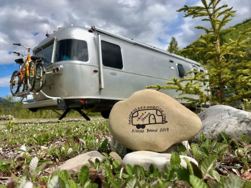
Part 2 of our Alaksa Adventures
Day 8 Monday June 10, 2019
Prophet River, BC to Racing River, BC
183 miles, 4.5 hours
Wildlife spotting galore today! Three separate bears (2 black, 1 brown), three separate white tailed deer, one moose, a family of four caribou, and 21 stone sheep including several lambs. Stone sheep are similar to Rocky Mountain big horn sheep but smaller and darker. They are found in northern BC and southern Yukon. These were along the highway in Stone Mountain Provincial Park. They are attracted to natural (from minerals in the rocky cliffs here) and artificial salt accumulations along the road.
So far we’ve been surprised by how good the road is. Today that changed. We started the drive on nice paved road but moved to bumpy chip seal, and then dusty gravel on the pavement, and finally through a construction zone where it looked like they were spreading muddy gravel over the road. Got our first rock chip in the windshield too.


Stopped for warm cinnamon buns (or rolls as we’d say) at Testa River. Chuck said they aren’t as good as the Maltby Cafe’s. 😉

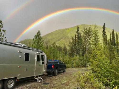
Thanks to the Wynns (gonewiththewynns.com) we have an awesome boondocking spot along the rushing Racing River with its pale, milky, turquoise water. The site is stunning!


Unfortunately today included a lesson in just how much space we really need to turn our trailer around. Even though we walked the spot before pulling in we underestimated our turning radius. Sure looked like enough room but with 8 foot drop offs on all sides it took moving the rock fire pit and some crazy maneuvering (ever made a 20 point turn?) with the truck at a 90 degree angle to the trailer, but we finally managed to get turned around. Rebuilt the fire pit and now we can enjoy the spectacular views. Speaking of spectacular views, we saw a double rainbow!
Day 9
Racing River, BC
Such a great spot we decided to stay another day and relax. Found 10 more bug bites today. I think it’s the no-see-ums. Boy am I itchy!
Didn’t realize we’re in for several days without cell service, but that’s ok. We’ll catch up with everyone soon. For now we’ve got books to read, blog entries to write and James Bond movies on the hard drive for the evening’s entertainment. Made an awesome pork chili last night (my instant pot is getting good use), but tonight I think it’s safe to break out the grill. We’ll keep the bear spray close just in case.
The days are getting long. It seems as we’ve moved north they’ve lengthened exponentially. Even just moving a hundred miles gets us another half hour of sun. I haven’t stayed up to check, but I think the sun isn’t going down until 11pm and this morning light was seeping in around the edges of our blackout shades at 4am. We’ve taken to sleeping with pillows over our heads to block it out. I have to shut all the shades at 9pm so my body gets the idea to start winding down for bed. About 10 more days until the longest day of the year. We’ll be in Alaska by then. I wonder if it will get dark at all.
Day 10
Racing River, BC to Liard River, BC
77 miles, 1.5 hours
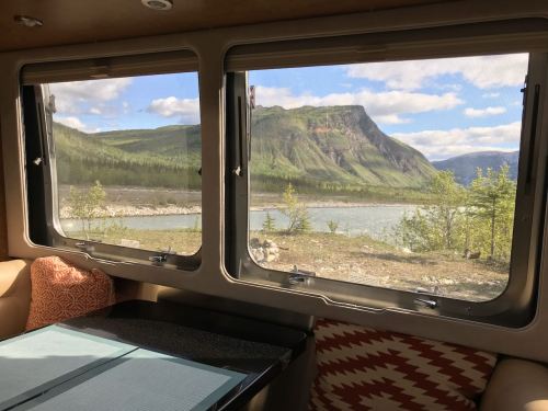
Drove along Muncho Lake today. It’s supposed to be a beautiful blue-green color, but the sun wasn’t out so we didn’t get to see it. Although there is supposed to be a lot of wildlife in that area the only thing we saw were a couple of bison on the side of the road. Was slow going because we were stuck behind several motorhomes going particularly slow. Not sure why because after the lake the road got really nice.

Pulled into Liard River Hot Springs just after 11am and got one of the last camping spots. Nice big gravel sites with trees between. I think I saw a mink running across a log.
Well, that great spot on the Racing River turned into a headache. When we were backing into our spot at Liard River I noticed the bumper looked weird. We must have caught a rock or something turning back onto the highway (it was a pretty steep shoulder). Caught the bottom of the trailer bumper and yanked it out several inches shearing off two bolts on the underside. Luckily the top bolts held and we didn’t lose the whole shebang or anything in the bumper storage. It took us (and by us I mean Chuck) a good hour to bend the bumper mostly back into shape by standing on it and gently bouncing and then reattach it. Thank goodness Chuck carries an assortment of bolts and screws!

After all that work we had lunch and a nice soak in the hot springs. I think this is a first for us both—a natural hot spring. It smelled slightly like sulfur and ranged in temperature from upper 90s to over 120. We found a spot to our liking and let the warmth sooth our muscles. It was nice that they covered the bottom of the pool in gravel. I was afraid it might be mucky. Now when I say pool, I mean where the river widens a bit, not a concrete pool. They have steps going down and a few benches to sit on although they were kinda slimy. The water was amazingly clear and it wasn’t too crowded.
I was worried because the description of this park said the sites were shaded. We’ve been doing pretty good on solar even with all the clouds we’ve had. Most days it’s bright through the clouds and we get a fair number of sun breaks so we’ve been keeping up well. We’ve even had enough power to run the refrigerator on battery during the day and we’re still using our induction cooktop. While there are lots of trees between the sites we have open sky above so we’re doing good.
Day 11
Liard River Hot Springs, BC to Big Creek, YT
175 Miles, 5.5 hours

Pretty boring drive today. Saw a bison in the distance along the Liard River and a brown bear along the road. As we passed, he was looking at us looking at him and then I think he saw a “bear-like” reflection in the trailer because he suddenly turned and ran back in the woods.
Stopped at the famous Sign Post Forest in Watson Lake. There were street signs, town signs and license plates from all over the world along with all kinds of homemade signs. Some carved in wood and others whatever travelers could find to write on—flip flops, plastic and metal plates, cookie sheets, frisbees. I left our mark with a sharpie on the back of another sign. The Forest was started by a soldier working on the Alaska Highway who was homesick so he stuck up a post with the distance to his hometown in Illinois. Now there are over 80,000 signs.
Went in the visitor’s center next door and the friendly lady loaded us up with all kind of information. She also told us we could fill our water there and dump for free a few blocks away. We were only half full but decided to take the opportunity. Now we’re set for a while longer.

Spending the night at Big Creek, a small Yukon Government campground. Oh yeah, we crossed into the Yukon Territory. The campsite is a deal at $12 Canadian (about $9 US) and includes free firewood although it is huge logs that require chopping. Downside is the mosquitos.
We keep ending up at the same place as a family from California, grandma & grandpa in one fifth wheel and mom dad and two kids in another. Finally met them today. Perhaps we’ll run into them again.
Day 12
Big Creek, YT to Whitehorse to north of Haines Junction, YT
320 miles, 8 hours
Our plan was to stay in Whitehorse for a few nights and rest, do chores, and explore. Unfortunately I didn’t think about it being a Friday so when we arrived at Wolf Creek government campground outside of town it was full. Made a quick call to the nicer RV park in town and they only had no-hookup sites by the freeway. Pulled into the other RV park and their sites were so tight we could barely open our door. We decided to drive on. We can visit Whitehorse on our way back south.
So we filled up with diesel and propane as the weather looks like it will take a turn. In fact it was pretty cloudy in Whitehorse. Tried to find DEF at the Walmart but they were out. Luckily Chuck snagged the last one at the nearby gas station as I walked over to Starbucks. Had to get fueled up for our trek further up the road. Haven’t been to a Starbucks in weeks. I wasn’t sure if the different drinks on the menu were because I was in Canada or they were new. Ever heard of a black sesame tea latte?
Heading north from Whitehorse we saw a woman jogging down her gravel driveway toward the road, a little dog running beside her and what looked to be a bear loping along about 15 yards behind her. I saw her looking over her shoulder at it. Hmmm, wonder how that turned out. The only other wildlife today was another bear in the distance a little north of our campsite, a pair of white, trumpeter swans flying across the sky north of Marsh Lake, and a prairie dog on the side of the road. Other than that it was lots of trees, endless trees, and a few ponds, rivers and lakes. To be honest the Yukon looks a lot like Washington, although the evergreen trees here tend to be tall and skinny and there are more deciduous tree mixed in. I think the main trees are white spruce and aspen with some poplar or alder.

We also hit more rough roadways, about 15 miles of dusty, gravel in one spot with lots of other shorter sections. We quickly learned that when you see a darker spot that looks like an asphalt patch, there is a good chance it is a pothole. Chuck spent a good amount of time dodging them today. Then north of Whitehorse we encountered our first frost heaves, marked with bright pink flags on stakes. Now I’m on road hazard patrol as well as my usual job of looking for deer, bear, or elk that might run out on the road.

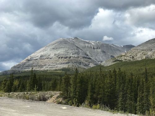
The weather improved and we had lots of sunshine. It made for great views of the snow and ice trails on the Kluane Mountains. Probably the best views we’ve had so far. Drove through Haines Junction, but didn’t like the looks of their RV parks, so kept on going. Finally stopped a ways north in a roadside pullout for the night. We’re not level, but we’re learning to be even more flexible these days. It was interesting getting the shower to drain. Had to use the squeegee to push the water in after I was done. Nice that we have cell service though. Got caught up with email and Instagram.

Day 13
Saturday, June 15, 2019
North of Haines Junction to Lake Creek government park, YT
117 miles, 3 hours
Didn’t sleep well last night. That makes two nights in a row. The constant light makes it hard for my body to get the message that it’s time for bed. I’m going to have to find a way to get some sleep though. We’re both feeling a bit road weary after yesterday’s long drive. Our original plan had been to take a break in Whitehorse for a few days and I think we needed it. But the drive yesterday was beautiful, and with today’s clouds we would have missed those great mountain views of the Kluane Range icefields.

Drove along Kluane Lake this morning. Found a few good spots right on the lake where we could have spent the night. Marked them for our return trip. Views of the lake weren’t as impressive as I expected, maybe because there was no sun. The road remained rough and bumpy. I guess this section of the Alaska Highway presents problems for the road engineers because of the layer of permafrost and boggy soil. Glad to stop early and take a break from the drive.

Pulled into another Yukon government campground and picked a spot along the creek right next to another Airstream. The sun was warm as Chuck got out the ladder and washed the solar panels. I was on bear patrol, armed with the bear spray just in case. They say this is grizzly country. We thought it would be cloudy all day so the sun is a nice surprise. Looks like it won’t last but that’s ok. We just want to relax this afternoon and maybe have a campfire tonight if it’s not raining.
Saw a pair of big white swans with pink on their necks/heads. Different from the black beaks of the trumpeter swans I saw yesterday. Other than that no wildlife to report.

Day 14
Lake Creek, YT to Tok AK
162 miles, 4.5 hours
Yep, we made it to Alaska! But more on that later. Last night I didn’t sleep any better. Around 10:45 pm I heard what sounded like a bus pull into the campground and whoosh its air breaks. After a half hour of the engine running, a few stints back-up beeping and high engine revs I finally got out of bed to take a look. It was a flat bed tow truck picking up the BMW and Airstream next door. We wondered why there was a jack sitting under the BMW and why we never saw the folks, after all Airstreamers are a pretty friendly bunch. It took another 30 minutes before they finally pulled out. So now I can report for sure that there is light at midnight, a kind of overcast day sort of light.
As soon as we pulled out of the campground today I saw a bear. Or rather I saw a bear statue. He was standing so still he looked liked a stuffed bear in a museum. Didn’t even look at me, just stared down the road. He was small and brown.
The road got worse today. I know I keep saying that, but it is true. Lots of frost heaves and potholes and not all of them marked by neon flags. They say this is the hardest section of the highway to maintain because of the permafrost. The road melts the frost creating a liquid soil that tends to sink. They are testing ways to keep the permafrost frozen but doesn’t look like it’s working because the test section was bumpier than the rest.
More of the same scenery, trees and little lakes. Taiga, meaning little brown sticks, is what they call this kind of forest and it is fitting. Lots of skinny black spruce that look kinda sickly because they are growing in the bit of soil above the permafrost. There would have been beautiful views of the mountains if it hadn’t been overcast. Saw several more trumpeter swans. I’m wondering if the other ones I saw were tundra swans as those are found in this area.

We were so excited to see the Welcome to Alaska sign. There is a 20 foot swath of cleared land marking the border that went on and on across the hills as far as I could see.

Crossing the border was easy. Just asked if we had tomatoes, peppers or citrus bought in Canada as those aren’t allowed. The agent was chatting away with us even though there was a line of cars behind. He asked if this was our first time and told us to stop at the Tetlin Wildlife Refuge up the road for a narrative guide. Unfortunately when we stopped they were closed. But just after crossing into Alaska I was welcomed by a moose sighting!

We thought the roads might get better when we crossed into Alaska, but nope. It seems even worse. We pulled over for lunch and were greeted by a huge mess. The upper cabinets swung open disgorging containers of food and pots everywhere. There is sugar all over the floor (luckily the only container that popped open). But worst of all a pot fell on the glass stove top shattering it. It is only a protective covering that you open to use the gas stove. We actually never use the gas stove since our solar powers an induction cooktop which we set on the glass stove top. So now we’ve lost nearly half of our limited counter space. But it can be fixed—another thing to add to our growing list of parts to order from Airstream for our return.

So after spending an hour and a half cleaning up all the glass and sugar and food strewn about, we ate lunch in a somber mood. Then we headed on up the road to Tok, a little of our excitement dampened just like we were after setting up in the pouring rain. This is the first day it’s rained pretty much all day.
Stay tuned for part 3 of our Alaska Adventures

Many thanks for delaying your Alaska blog entries. This allows us to relive our Alaska trip in 2019! I don’t think we saw you on that trip though…
LikeLike
Seems like it was eons ago. Don’t think we saw you. Hope your travels were less eventful than ours.
LikeLike
Keep these Alaska posts coming! I am loving them!
LikeLike
Nice Airstream!!
LikeLike
Wonderful post! Love the Airstream too. My wife and I are planning this trip for next summer (51+ weeks away) so my planning for it is in high gear.
LikeLike
Enjoy your planning—sometimes that’s half the fun. Hopefully you find something here that helps. Safe travels.
LikeLiked by 1 person